Pin Drop
gamefinity.io · Geography
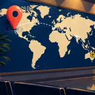
Turns the Worldle question inside out: you are told the place and must find it on an unlabeled world map, five times a day, with your distance set against the crowd's.
Worldle shows the silhouette of a single country or territory and gives you six guesses to name it. After a wrong answer it reports the distance from your pick to the target, an arrow pointing the way and a percentage for how close you are. That feedback turns a blob of coastline into a solvable puzzle, and once you have the answer, bonus rounds ask more about the same place.
Picks were chosen for recognizing places from partial information and narrowing in with distance or direction clues. The list opens with a map-pinning game that asks the question in reverse, continues with the nearest relatives of Worldle's outline format and hint system, and ends with photo and neighbor games.
Turns the Worldle question inside out: you are told the place and must find it on an unlabeled world map, five times a day, with your distance set against the crowd's.
From the same maker as Worldle and nearly identical in play, with the outline of a U.S. state in place of a country and the same distance and direction clues after misses.
Also asks you to read a country's shape, but the border is drawn piece by piece while you hold a button, so naming it sooner means trusting a partial outline.
Reverses the silhouette challenge: given a country's name, you sketch its borders from memory and receive a score for how well they match, a good test of how well Worldle shapes have stuck.
Uses the same six guesses and distance-and-direction arrows as Worldle, but the clue is a chart of what the country exports rather than its outline.
Drops the shape clue and lets the globe itself guide you, coloring each country you name by how near it is to the answer and letting you guess as long as you need.
Reveals a flag one tile per guess within six tries and then, much like Worldle, follows the main answer with bonus questions about the country.
Narrows down a mystery country through comparisons rather than a picture: continent, hemisphere, population and climate all point you toward the answer.
Made by the Worldle developer, it trades the outline for a single photograph and asks which country or territory it shows, followed by extra questions on the same location.
Starts from one landscape view instead of a map shape, with six attempts and the distance to the right country shown after each miss, close to Worldle's own feedback.
A photo clue with distance feedback measured to each wrong country's center, so you can triangulate the way Worldle players do with its kilometer readout.
Keeps you thinking about neighboring countries, the skill Worldle's direction arrow builds: you connect two nations by working out which countries lie between them, one border at a time.
Asks for every country that borders the one highlighted, practice for the regional knowledge that makes Worldle's distance clues easier to use.
No. The names are one letter apart, and Worldle borrowed Wordle's six-guess daily format, but the answer is a country or territory identified by its shape, not a word. Worldle was made by an independent developer and is not one of the New York Times puzzles, though it plays just as quickly.
Not at all. A first guess in roughly the right region gives a distance and an arrow, and those two clues together often narrow the answer to a handful of countries. Small islands and territories are the tricky days; Statele, from the same developer, is a gentler place to practice reading outlines with far fewer possible answers.
Flagle and WhereTaken both follow the main answer with extra questions, as Worldle does. Flagle quizzes you on the country's outline, capital city and bordering countries once you have named its flag, and WhereTaken asks about the place in its photo. WhereTaken USA, from the same maker, applies the photo format to American states.