







Pin DropEditor’s pick
gamefinity.io · Geography
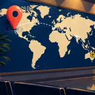
Five places and one blank world map. Pin each one, then see how your distance compares with everyone else's.
These are the daily games for map people: outlines to recognize, flags to read, borders to walk across and street photos to place. Most give hints by distance and direction, so a wrong guess still teaches you something.
Each one is free to play in a browser. Reset times are shown in your own time zone where the game publishes them.
Five places and one blank world map. Pin each one, then see how your distance compares with everyone else's.
Choose the right capital city from four options, build a streak and race a ninety-second clock.
Recreate every national flag by filling in its colors from memory, 195 in all, with three lives and no time limit.
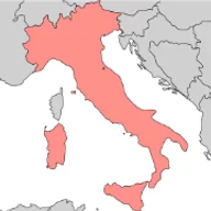
Name the country whose silhouette is shown within six guesses; each miss reports distance and direction to the answer, and bonus rounds follow.
Type any country and watch it shade the globe in warmer colors the closer it sits to the hidden one; there is no guess limit, only your count.
Hunt for a hidden capital city on a 3D globe, where each wrong pick is colored by its distance and joined by arcs that narrow the search.
Each guess uncovers another tile of a hidden flag; identify the country within six tries, then continue into bonus rounds on its shape, capital and neighbors.
Link two countries by naming the chain of neighbors between them, within a guess allowance set by the route; three optional hints can sketch outlines or initials.
Identify a U.S. state from its outline in six guesses, with each wrong answer showing how far off and in which direction the target lies.
Read a treemap of one country's exports and name the country in six guesses, with distance and direction hints after each miss.
Pin down a mystery country as each guess is compared with it on continent, hemisphere, population, average temperature and compass direction.
Work out the hidden country's flag in six attempts, guided by a score that rates how closely each flag you try resembles the answer.
Complete a three-by-three board using flags that satisfy both a row trait and a column trait, like colors or history, and seek the one flag fitting every category.
Sort a board of geography tiles, from internet domains and land areas to flags, into hidden themed groups before your lives run out.
Fill a nine-cell board with countries that meet one row and one column condition, like NATO membership or flag colors; less common correct picks earn higher rarity tiers.
Look at a photo and name the country it came from; each wrong pick shows the distance between the photo's spot and that country's center.
Start the clock, read the first hint, and click the mystery country on a zoomable world map, with fresh hints arriving after every wrong click.
Tap five places on a rotating 3D globe, scoring more the nearer you land to each, with a short historical story attached to every location.
Name every country that shares a border with the one highlighted on the map, choosing from a full country list.
Each historic photo asks where on Earth and in what year it was taken, answered with a map pin and a year slider; the daily round uses five shots.
Pin the spot where you think a photo was shot and choose its year on a slider; optional hints and a commentary bot can nudge your reasoning.
Study a photograph and name the country or territory where it was shot, then unlock bonus rounds about that place.
Name the U.S. state or territory shown in a photograph, with proximity hints after misses, then move on to bonus questions about it.
Five head-to-head questions ask which of two places ranks higher on a census-style statistic such as poverty rate, with difficulty climbing each round.
Search a world map for the spot where the day's treasure lies, narrowing in with each attempt; normal and expert difficulties are offered, plus player-made hunts.
Identify a country from fragments of its flag, with a master mode for extra difficulty; an optional paid full version unlocks more.
Sixteen Street View snapshots hide four countries; group the tiles by country, with easy and expert settings and puzzles growing harder from Monday through Sunday.
Sketch the named country's borders freehand and get scored on the match; limited hints can briefly flash the shape or uncover a stretch of the border.
Guess the hidden country or territory while the map reacts, fading out wrong continents and pointing you closer; there is no cap, so aim for the fewest guesses.
From a single scenic view, figure out the country within six attempts, with the distance to the answer shown in kilometers or miles after each miss.
Travel from a starting city to a target city by hopping between nearby cities, using the fewest jumps; a weekly rule-twist challenge and a route-reveal mode add variety.
Shown a passport design, name the country that issued it; the small game was built by its creator for a circle of friends.
Pan and zoom around four travel photos hunting for clues, then drop a marker on the map; the nearer each pin lands, the higher your score.
Hold a button to trace a country's border bit by bit and name it as early as you dare; seven countries make up each set.
Given a country's name, recreate its flag without a reference using brush, fill and shape tools, then see a percentage score against the real thing.
Explore a world map to pin down a mystery city, picking up another clue after each wrong guess, in Sporcle's numbered series.
Judge seven flags in turn and call each one genuine or invented; players can also submit their own designs for future rounds.
Watch a video of one real person and name the country they represent, with three guesses and eight optional clues that cost more points as they get easier.