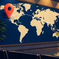
The best daily geography games, from outlines to map pins
Updated · By the Today's Dailies editors
Most geography dailies share a habit: a wrong answer still teaches you something, since the game answers it with a distance, a direction or a color that shows how near you came. What changes from game to game is the clue you start from. It might be a country’s outline, a blank globe, two countries to connect, a photograph, a flag or a place to find on the map.
This page groups the map games by that starting clue, with two or three in each group. Every one is free in a browser with no account needed for the daily round, and most switch to a new puzzle at your own local midnight.
Name the hidden country
A single mystery country, with a different clue to find it by: an outline, a globe that warms up as you close in, or a page of electricity figures. The Worldle alternatives and Globle lists hold many more.
Six tries to name a country or territory, shown only as a silhouette. Misses are measured center to center, so even a next-door neighbor can show a gap of 2,000 kilometers, and an arrow points one of eight ways. Bonus rounds on the capital, flag and neighbors follow, and no answer repeats within 100 days.
Nothing to look at but a globe. Each country you name is colored by its distance from the answer, measured as the shortest gap between borders, so anything touching the answer shows as hottest. Guesses never run out and only your count matters, which makes it forgiving for anyone learning the map.
The mystery country is described only by its electricity: yearly output, demand per person, imports and exports, the mix of sources and the carbon behind each kilowatt-hour, with most figures compared against the world average. You get six guesses, and a Clue Shop trades spare ones for hints. A natural pick for people who follow energy and climate.
You get a start country and an end country, and you name every country on a walk between them. Each guess is marked by whether it lies on a shortest path, and the guess allowance is sized to the route, so detours hurt. Three optional hints help, and a Weekly Challenge comes out on Mondays.
Travle’s idea at city scale. From a starting city you hop to any city inside the jump radius, then keep hopping toward the target, where every jump counts against you. The radius and a count of the cities in range are shown up front, and a weekly challenge adds one special rule.
Worldle in reverse: the day’s country is named, and you draw its outline freehand, earning up to 1,000 points for the fit. Hints come in two kinds with three uses apiece: one flashes the shape, the other adds a dashed stretch of the true border. Your drawing is then laid over the real one, right parts in green.
Five places a day on a 3D globe you turn with a finger, and every tap scores more the nearer it lands. Each spot comes with a little history attached, so a round leaves you knowing something about where you looked. The menu adds practice, player-made levels and a versus mode.
Five places a day on a flat world map with no labels at all, from well-known cities to less familiar spots. Pan and zoom, set your pin, and each answer shows how far off you were beside the average pin of that day’s players. New places arrive when it is midnight in New York.
A hidden flag is uncovered one tile per guess, and you have six guesses to name its country. Every miss also reports a distance, a direction and a closeness percentage, so geography helps when the flag does not. Bonus rounds on the outline, capital and neighbors follow, and City Flags and Emblems sit in the menu.
One photograph, and you say where in the world it was taken, down to the country or territory. A wrong answer earns a closeness percentage drawn as green and yellow squares, and solving the photo opens three bonus rounds on the same place, each unlocking the next. Earlier days need a paid Teuteuf Premium sign-up.
Asks where and when. For each of five photos you drop a pin and set a year between 1860 and today, with up to 100 points for the place and 100 for the year. Hints cost no points, though each one leaves a bulb in the result you share.
Globle’s hot and cold globe aimed at one capital city. Each capital you enter lands as a marker colored by its distance from the answer and sized by its population, with arcs joining your guesses. Where a country has more than one capital, only its political seat counts. Practice games are there until the next capital arrives.
Worldle’s format for the United States, from the same maker: six guesses to identify a state by its outline, each miss giving a distance, a direction and a percentage. The pool of 56 also takes in Washington, D.C. and territories such as Puerto Rico, and no answer returns within 40 days.
The rule for a place on this page is the site’s own: a listed game that costs nothing, plays in a web browser and lets anyone start the daily round without an account. Each link is retested overnight, and every reset time on this page was read off the game’s own site or its countdown. The picks are grouped by the clue a game opens with and compared, not ranked. All 13 picks were opened in a phone-sized browser between November 4 and November 5, 2026 and loaded, and each one fit the screen without sideways scrolling.
What is the difference between Worldle and Globle?
Worldle shows a country’s outline and gives you six guesses, with a distance, an arrow and a percentage after each miss. Globle shows no outline at all: each country you name is colored on a globe by how close it lies, and guesses are unlimited. Both switch to a new country at local midnight.
When do daily geography games reset?
Most of these switch at local midnight, wherever you are: Worldle, Globle, Travle, Flagle, Statele, WhereTaken and WhenTaken among them. Pin Drop changes at midnight New York time. For every listed game that publishes a reset time, see the reset times page.
Are there daily map games where you tap the location?
Yes. MapTap names five places a day on a globe you can spin and scores each tap by distance, and Pin Drop does the same on a flat, unlabeled map, setting your distance beside the day’s average. WhenTaken asks for a pin and a year for each photo.